


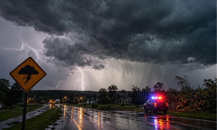
Severe thunderstorms have again become a concern across South Carolina as powerful summer storms brought damaging winds, heavy rainfall, frequent lightning and hail to parts of the state. Recent National Weather Service warnings show that several South Carolina counties experienced thunderstorms capable of producing 60 mph wind gusts, hail and dangerous lightning, with some storms also producing torrential rainfall and localized flooding.
The recent weather activity is a reminder that South Carolina can experience rapidly developing thunderstorms during the hot and humid summer months. Storm cells may strengthen quickly, creating hazardous conditions for drivers, outdoor workers and residents who are caught outside.
Recent warnings have particularly affected portions of central South Carolina, including areas around Columbia, Lexington, Richland, Calhoun, Aiken and Orangeburg counties. Residents are being encouraged to monitor official weather alerts because conditions can change significantly within a short period.
Recent Severe Thunderstorm Activity in South Carolina
The latest weather records show several rounds of strong to severe thunderstorms moving through parts of South Carolina in August 2026.
On August 6, the National Weather Service office in Columbia issued severe thunderstorm warnings affecting portions of Aiken, Calhoun, Lexington, Orangeburg and Richland counties. The warnings included a threat of 60 mph wind gusts, hail and frequent cloud-to-ground lightning.
Another warning later that afternoon covered portions of Calhoun, Lexington and Richland counties, with the National Weather Service again identifying 60 mph wind gusts and hail as the primary hazards.
Strong thunderstorms also affected the region on August 10, when a severe thunderstorm warning covered parts of Calhoun, Clarendon, Lexington, Sumter, Orangeburg and Richland counties. The storms were moving southeast at approximately 30 mph and were capable of producing 60 mph wind gusts and penny-sized hail.
These events demonstrate why residents should not assume that a storm is harmless simply because it is moving quickly.
Which South Carolina Counties Were Recently Affected?
Recent National Weather Service warnings have included a number of counties in central and eastern South Carolina.
Among the counties specifically named in recent warnings were:
- Aiken County
- Calhoun County
- Lexington County
- Richland County
- Orangeburg County
- Fairfield County
- Kershaw County
- Newberry County
- Sumter County
- Clarendon County
The exact counties under warning can change from one storm to another. A county that is quiet during one storm may be placed under a warning later as another cell develops.
For that reason, residents should rely on the current warning for their location rather than assuming that an earlier county list remains valid.
What Hazards Are South Carolina Storms Producing?
Recent warnings show that damaging wind and hail have been among the most significant threats.
Damaging Winds
Several recent warnings identified wind gusts of approximately 60 mph. Winds at this strength can break tree limbs, damage vulnerable structures and create dangerous conditions around power lines.
Even when a storm does not produce a tornado, straight-line winds can cause considerable damage.
Drivers should be particularly cautious around:
- Fallen trees
- Downed utility lines
- Road debris
- Damaged traffic signals
- Sudden heavy rain
- Reduced visibility
Hail
Hail was also reported as a threat in several recent warnings.
The National Weather Service documented hail ranging from penny-sized hail to larger hail in some August 6 warnings. One later statement reported hail up to approximately one inch in diameter.
Hail can damage:
- Vehicles
- Roofs
- Windows
- Outdoor equipment
- Crops and gardens
If a severe thunderstorm warning specifically mentions hail, residents should move vehicles under secure cover when it is safe to do so and stay away from exposed windows.
Torrential Rainfall
Heavy rain can accompany even relatively short-lived summer thunderstorms.
A National Weather Service statement issued for central South Carolina warned that torrential rainfall could lead to localized flooding and specifically advised people not to drive through flooded roads.
Flooding is especially dangerous because water depth can be difficult to judge from inside a vehicle.
A road that appears passable may contain:
- Deeper water than expected
- Washed-out pavement
- Hidden debris
- Open drainage areas
- Strong currents
The safest decision is to avoid flooded roadways altogether.
Lightning Remains a Major Threat
Lightning is another important danger during South Carolina thunderstorms.
Recent National Weather Service statements noted frequent cloud-to-ground lightning with strong storms moving across central South Carolina.
Lightning does not require a storm to be directly overhead to become dangerous. If thunder can be heard, people should already be seeking shelter.
During a thunderstorm:
- Go inside a substantial building or enclosed vehicle.
- Stay away from windows.
- Avoid outdoor activities.
- Avoid standing beneath isolated trees.
- Wait until the storm has safely moved away before returning outside.
Outdoor sporting events, construction work, boating and other activities can become particularly dangerous when thunderstorms develop nearby.
Is There a Tornado Threat?
Tornadoes are possible with some severe thunderstorms in the Carolinas, but they should not automatically be reported as occurring every time severe thunderstorm warnings are issued.
This distinction matters.
A severe thunderstorm warning means dangerous thunderstorm hazards have been detected or are strongly indicated, such as damaging winds or large hail.
A tornado watch means conditions are favorable for tornado development.
A tornado warning means a tornado has been detected by radar or reported by reliable observers.
Residents should therefore pay attention to the exact wording of their alert rather than treating every severe thunderstorm warning as a tornado warning.
If a tornado warning is issued, people should immediately move to a small interior room on the lowest practical floor and stay away from windows.
Why South Carolina Thunderstorms Can Intensify Quickly
Summer thunderstorms in the Southeast can develop rapidly when warm, humid air combines with atmospheric instability and other favorable conditions.
That makes timing especially important.
A morning forecast may suggest only a general chance of thunderstorms, while conditions later in the afternoon can become considerably more active.
Recent storms around central South Carolina demonstrated how individual cells can strengthen and generate severe-weather warnings within a relatively short period. On August 6, for example, thunderstorms tracked across Lexington and Richland counties before additional warnings were issued as storms moved through surrounding counties.
This is why checking the forecast once in the morning is not enough on a potentially stormy day.
Columbia and Surrounding Areas Face Repeated Storm Threats
The Columbia area and surrounding Midlands communities have featured prominently in recent severe thunderstorm warnings.
Recent National Weather Service alerts specifically referenced locations including:
- Columbia
- Lexington
- West Columbia
- Cayce
- Irmo
- Forest Acres
- Red Bank
- Gaston
- Hopkins
- South Congaree
- Pine Ridge
Some warnings also referenced major travel routes including portions of Interstate 20, Interstate 26 and Interstate 77.
For commuters, this means a storm can affect not only homes but also major transportation corridors.
Heavy rain, lightning and strong winds can make an otherwise normal afternoon commute considerably more dangerous.
What Should Residents Do During a Severe Thunderstorm Warning?
When a warning is issued for your location, do not wait until the storm appears directly overhead.
Take these steps:
- Move indoors immediately.
- Stay away from windows and exterior doors.
- Bring loose outdoor objects inside if conditions allow.
- Avoid unnecessary driving.
- Keep your phone charged.
- Monitor official weather updates.
- Prepare for a temporary power outage.
If you are already driving when severe weather develops, avoid stopping beneath trees or power lines. If visibility becomes extremely poor, find a safe location to shelter rather than continuing through hazardous conditions.
What to Keep in a Severe Weather Kit
A basic household storm kit does not need to be complicated.
Consider keeping:
- Flashlights
- Spare batteries
- Portable phone chargers
- Drinking water
- Basic food supplies
- Necessary medications
- First-aid supplies
- Battery-powered weather radio
- Important emergency contact information
The most useful time to prepare this equipment is before the warning is issued.
Once a severe thunderstorm is already approaching, power outages and poor weather conditions can make preparation much more difficult.
What About Power Outages?
Strong winds and falling branches can damage electrical infrastructure.
Recent National Weather Service warnings specifically warned of potential damage to trees and power lines from 60 mph wind gusts.
If the power goes out:
- Stay away from fallen power lines.
- Treat every downed wire as dangerous.
- Use flashlights rather than candles when possible.
- Keep refrigerators and freezers closed as much as possible.
- Report outages through your utility provider.
- Never attempt to remove a fallen electrical line yourself.
Storm damage can remain dangerous long after the thunderstorm has moved away.
Flooded Roads Are Especially Dangerous
One of the simplest but most important storm-safety rules is to never drive through flooded roads.
Water can hide damaged pavement, debris or other hazards. Moving water can also push vehicles off the roadway.
The National Weather Service has repeatedly emphasized avoiding flooded roadways during heavy thunderstorms in South Carolina.
If you encounter a flooded road, turn around and find another route.
Saving a few minutes is never worth risking your life.
How to Follow South Carolina Weather Alerts
Weather information can change quickly, so residents should use reliable official sources.
Useful sources include:
- National Weather Service alerts
- NOAA Weather Radio
- Local emergency-management notifications
- Local television weather coverage
- Official county emergency alerts
- Smartphone emergency notifications
The National Weather Service’s Columbia office provides current watches, warnings, advisories, radar and forecast information for much of central South Carolina.
The important point is to check current alerts, not an old social-media post or an outdated screenshot.
Severe Weather Can Affect Daily Plans
Thunderstorms can disrupt normal activities even when widespread damage does not occur.
Schools, businesses, sporting events, outdoor construction and travel may all be affected by severe weather.
Parents should check school or district announcements when storms are expected, while businesses with outdoor workers should have procedures for moving employees indoors quickly.
Event organizers should also have a clear plan for lightning and severe thunderstorms rather than waiting until the storm arrives.
What to Do After the Storm
The end of rainfall does not necessarily mean all hazards have disappeared.
After a severe thunderstorm:
- Avoid downed power lines.
- Watch for unstable trees and branches.
- Stay away from damaged buildings.
- Do not drive around barricades.
- Photograph property damage when safe.
- Report dangerous conditions to the appropriate authorities.
- Check on vulnerable neighbors if you can do so safely.
Trees can remain unstable after being damaged by strong winds, and electrical hazards may persist for hours.
The Bigger Lesson From Recent South Carolina Storms
The recent August 2026 warnings highlight an important point: severe weather does not always arrive as one massive statewide event.
Instead, individual storm cells can develop, intensify and move across selected counties while neighboring areas experience much less severe conditions.
On August 6, for example, different warnings successively covered portions of Aiken, Calhoun, Lexington, Orangeburg, Richland and surrounding counties, with repeated threats from 60 mph winds, hail and lightning.
That makes localized alerts extremely important.
A person living only a few miles outside a warned area may experience very different conditions from someone directly under the storm core.
Final Update
South Carolina remains vulnerable to fast-moving summer thunderstorms capable of producing damaging winds, hail, torrential rainfall, lightning and localized flooding. Recent National Weather Service warnings in August 2026 confirm that these threats have already affected multiple counties, particularly across central portions of the state.
The safest approach is to remain weather-aware, take warnings seriously and act before conditions deteriorate.
Do not wait for visible damage before seeking shelter. If a severe thunderstorm warning is issued for your area, move indoors, stay away from windows, avoid unnecessary travel and continue monitoring official updates.
For the latest situation, residents should always check current National Weather Service and local emergency alerts because county coverage, storm intensity and warning times can change rapidly.
